Laser Precision: LiDAR Technology Enables Successful Completion of the Annual H-Canyon Exhaust Tunnel Inspection
Savannah River National Laboratory (SRNL) personnel from the Global Security Directorate (GSD) Asymmetric Engineering and Technology group recently supported the successful completion of the annual Department of Energy (DOE) required H-Canyon Exhaust Tunnel (H-CAEX) Light Detection and Ranging (LiDAR) inspection. Since 2003, a team from Savannah River Nuclear Solutions (SRNS) and SRNL has remotely inspected the H-CAEX Tunnel annually for structural integrity, per DOE requirements. LiDAR uses a laser beam to measure the interior dimensions of H-CAEX Tunnel, which provides quantitative measurements to help determine the tunnel’s longevity.
H-Canyon is the only production-scale, radiologically shielded chemical separations facility still in use in the United States. H-Canyon utilizes an underground sand filter to remove radioactive particulates for air purification. The underground exhaust tunnel between H-Canyon and the sand filter needs to be inspected regularly for structural integrity. To predict the remaining service life of the H-CAEX Tunnel to support current and future H-Canyon missions, the use of LiDAR technology inspection has been used. Since November 2019, a LiDAR system has been deployed annually in the H-CAEX Tunnel to inspect a specific area known as the “Pitot Tube” location. The goal of LiDAR inspections is to obtain quantitative measurements to determine the erosion rate of the tunnel’s interior concrete surfaces. Annual deployments provide invaluable LiDAR operational experience and yield improved data analysis with each deployment.
Prior to the inspection, GSD’s Asymmetric Engineering and Technology group performed pre-inspection readiness checks of the inspection system. Johnna Gregory, principal engineer, was impressed with the field briefing during the deployment. “Willie (Wells) performed a good field briefing on the technology to the H-Canyon Facility Manager Matt Arnold when he visited and observed the field deployment station in operation,” said Gregory. “I could see that he was very impressed and is looking forward to the final analysis and report.”
During the inspection, the team encountered Wi-Fi issues that were resolved by outlining the steps for replacing the wireless access point that stopped working. “It was great seeing the LiDAR team in action in H-Area. Their efforts on this task are appreciated,” said Instrumentation, Robotics & Imaging Systems Manager Rick Minichan. “Thanks to their persistence and focus, we were able to get through the Wi-Fi challenge under pressure in the field and complete the scans. Another job well done.”

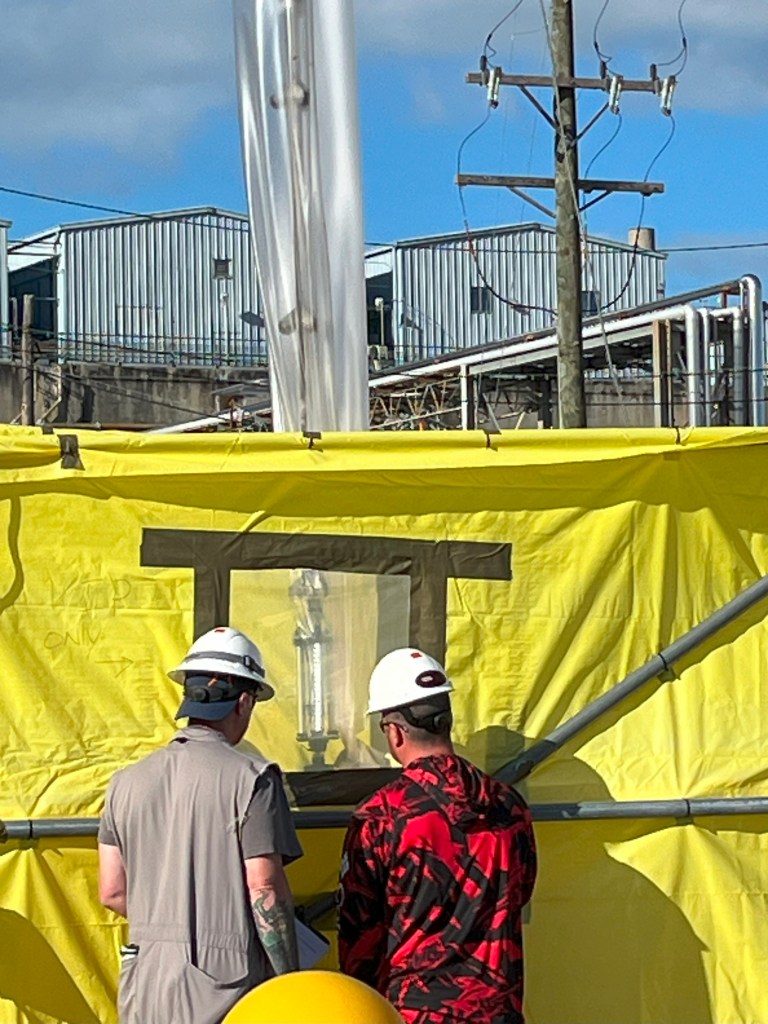
Rigging and operations personnel are watching the LiDAR and light assembly as it descends into the tunnel during this year’s inspection.
The Asymmetric Engineering and Technology group also provided equipment to view completed scans. The data from the LiDAR scans are used to create 3D models to evaluate whether a surface erosion rate can be determined. The surface erosion rate is used to predict the expected remaining service life of the H-CAEX Tunnel. This prediction includes the time required to complete the present H-Canyon missions, as well as time after H-Canyon is shut down. Once H-Canyon is shut down, the tunnel will remain in use.
Since 2019, six inspection datasets from the HCAEX Tunnel have been collected and two inspections were performed in 2020 to prove repeatability. The knowledge gained from these local deployments will likely be applied to future H-CAEX Tunnel unmanned ground vehicle inspections to provide a complete understanding of tunnel conditions.
In FY24 the team will begin testing an Ouster OSDome LiDAR, a system that is equipped with a 360-degree horizontal field of view and a 180-degree vertical field of view with real time controllability, for the next unmanned ground vehicle inspection of the HCAEX Tunnel.