“So, we came up with the concept of measuring the controlling chemical variables that cause contaminants to be released into the groundwater, and by measuring those, we can actually predict movement before it even happens…” – Carol Eddy-Dilek, SRNL ALTEMIS Program Manager

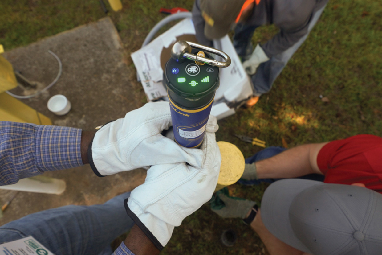
Close-up of ALTEMIS monitoring device.
photo: Brad Bohr
Researchers at Savannah River National Laboratory (SRNL), in concert with Lawrence Berkeley National Laboratory, Massachusetts Institute of Technology, Pacific Northwest National Laboratory, and Florida International University, are leading the Advanced Long-Term Environmental Monitoring Systems (ALTEMIS) Project to move groundwater cleanup from a reactive process to a proactive process, while also reducing the cost of long-term monitoring and accelerating site closure.
Reducing the cost of long-term monitoring is a priority for the Department of Energy (DOE), as the agency’s liability for long-term monitoring is projected to expand for decades and cost billions of dollars.
Using Artificial Intelligence and Machine Learning (AI/ML) techniques, the ALTEMIS program is poised to provide a monitoring capability for use throughout the DOE complex that is designed to predict future contaminant flux by tracking real-time master variables that predict contaminant migration and provide early warning of unwanted plume behavior.
“The typical long-term monitoring paradigm is to have a network of sampling wells, send humans to the field to take samples—typically quarterly—analyze the samples in the lab for a variety of contaminants, and identify if contaminant concentrations exceed regulatory limits,” said Thomas Danielson, Ph.D., Principal Scientist in SRNL’s Environmental Sciences and Dosimetry group. “The Government Accountability Office estimates the long-term monitoring liability for EM to exceed $500 billion, and a large portion of this cost is related to these sampling efforts.”
Long-term monitoring is necessitated by the widespread implementation of passive processes for remediation of complex groundwater plumes. Active remediation is very expensive and requires pumping contaminated groundwater out of the ground, treating it and injecting the clean water back into the ground. Passive remediation strategies are based on addition of an amendment to the groundwater to precipitate the contamination, removing it from the ground water but leaving the contaminant in the ground as a solid precipitate that won’t dissolve back into the groundwater. This passive approach brings with it considerable cost savings when compared to active remediation techniques; however, it requires continued monitoring of the attenuated contaminants. This new approach led to discussion of how monitoring could be done more effectively.

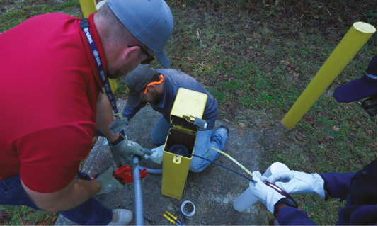
Researchers install a monitoring device in a well.
photo: Brad Bohr
“On the Savannah River Site, in F-Area, we have worked with the site customer to successfully implement an innovative passive remediation system, so now our team has been focused on a better approach for effective monitoring of this new system,” said Carol Eddy-Dilek, program manager for ALTEMIS at SRNL. “Most people are talking about placing sensors in the [monitoring] wells to measure the contaminant concentrations. These sensors tend to be very expensive and require frequent calibration.
We came up with an alternative concept based on the paradigm that a contaminant plume is essentially a subsurface geochemical perturbation that is not in equilibrium with the environment. In F-Area, we have all these radionuclides in the groundwater plume and the pH is around 2, with the background pH around 5 to 6, a very significant geochemical shift. We need to monitor to ensure that the attenuated contaminants remain stable as the groundwater system, specifically pH, returns to baseline conditions over the next two or three decades. So, we’ve implemented a monitoring system focused on measuring key geochemical changes,” said Eddy-Dilek.
“We can’t have a big release of attenuated strontium or something like that,” she said. “So, we came up with the concept of measuring the controlling chemical variables that cause contaminants to be released into the groundwater, and by measuring those, we can actually predict movement before it even happens,” said Eddy-Dilek. “It’s a real paradigm shift.”
Because this is the first implementation of this approach for groundwater monitoring, it requires substantive validation of the robustness of the system. Past research activities at F-area included detailed subsurface characterization, where geologic layers in the ground that control contaminant movement were mapped and characterized. The resultant information was then integrated into the development of a sophisticated reactive transport model that can be used to evaluate the innovative monitoring approach.
“That allows us to look at how and where the uranium is going to move in the future and how the geochemistry is going to change over time,” said Eddy-Dilek. The model allows the team to use decades of past sampling data to predict what will happen in the future.
“By incorporating passive in-situ sensing technologies and artificial intelligence/machine learning with the reactive transport model, we can shift the paradigm from reactive sampling to proactive long-term monitoring by measuring data that can indicate changes in the environmental conditions such as hydrological, geochemical and geophysical, and then using those data to make predictions or forecasts of what the resulting impacts will be to contaminant concentrations in the future,” said Danielson.
According to Danielson, not only does ALTEMIS represent a seismic shift in monitoring effectiveness, ALTEMIS has the potential to reduce the long-term monitoring costs by up to 90 percent.
“AI/ML plays several key roles in ALTEMIS and long-term monitoring, said Danielson. “First, it allows us to characterize the system by identifying geo-physical and chemical master variables that are strongly correlated with contaminants of concern. In other words, it tells us what data we need to be measuring for a given system. It also enables spatiotemporal optimization for location of the sensor networks, telling us how frequently and where we need to be measuring the data,” he said.
Danielson said that balancing both cost and data quality is part of the process, noting that installing too many sensors would increase costs and potentially lead to less accurate datasets. He also said use of AI/ML allows prediction of contaminant concentrations out into the future with high enough accuracy to guide decision making.
The ALTEMIS Project sensors transmit data via a cellular network to the cloud where researchers from several institutions can access the data to apply ML techniques or to incorporate spatiotemporal data into deterministic hydro-geophysical and chemical models. There is an array of sensor types in addition to the sensors located in wells.
Another key need for F-Area is to prevent migration of any contamination from the residual waste disposed on the onsite disposal facility. The ALTEMIS team deployed resistivity tomography system in the basin cap by installing a cable with electrodes measures the conductivity of soil, according to Hansel Gonzalez-Raymat, a senior scientist in SRNL’s Environmental Sciences and Dosimetry Group. “And the cool thing is you can detect the conductivity of the soil at different depths,” said Gonzalez-Raymat. “You’ll be able to see if conductivity has changed at different depths after a rain event indicating a leak in the cap. We’re using this approach to ensure the protectiveness of the cap” he said. “With the sensors, you can see what is happening within the cap, so when you see changes in conductivity, you’ll be able to tell if the cap was degraded or leaking,” Gonzalez-Raymat said.
The paradigm shift is underway in other locations beside the Savannah River Site’s F-Area.
”We are working to apply ALTEMIS techniques to groundwater plumes containing heavy metal contaminants emanating from facilities containing coal combustion residuals,” said Danielson. “We are also applying AI/ML for mercury vapor monitoring at Oak Ridge’s Y-12 legacy mercury use facilities to understand controlling variables, meteorological driving forces, and make predictions of mercury vapor releases inside buildings undergoing deactivation and decommissioning. That work is guiding worker safety,” he said.
“Now we need to start talking to the [state] regulators and stakeholders, to educate them about the benefits of the system,” said Eddy-Dilek, “If we’re going to institutionalize this, maybe we can use these techniques to improve long term monitoring and minimizing costs by reducing the locations and frequencies of well sampling and analysis.”

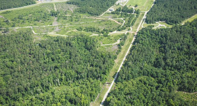
This area of wetlands and sediment-capped basins is being monitored by ALTEMIS.
photo: Savannah River Site Photography
While ALTEMIS can be applied to at least nine DOE sites, the system is not a one-size-fits-all. The variables ALTEMIS will monitor for are determined in part by the ML that shapes the model and determines the correlations between the controlling geochemical factors and the contaminants. That information determines what needs to be monitored and how frequently.
“So, for Moab, Utah, we’re also thinking about using electrical resistivity tomography, but the application is different,” said Eddy-Dilek. “ We’re looking at putting electrodes on the surface to monitor the stability and location of ammonium plume, because the conductivity of the ammonium plume is fundamentally different from the overlying groundwater. At F-area we’re talking about a depth of 10-feet, at Moab we’re looking at about 100-200 feet below the surface,” said Eddy-Dilek.
The DOE-EM mission is, “to address the nation’s Cold War environmental legacy resulting from decades of nuclear weapons production and government-sponsored nuclear energy research.” That legacy contains some of the most challenging radioactive sites. With the responsibility for completing cleanup of these nuclear materials, being able to leverage new technologies like ALTEMIS has the great potential to reduce costs and speed site closure.